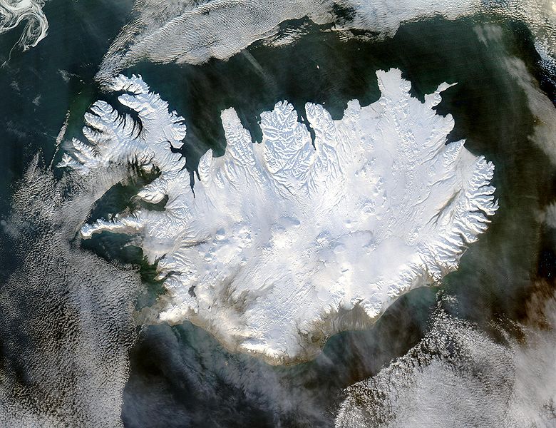
tóng-àn:Iceland satellite.jpg

Seng khoàⁿ chiàm-liōng: 780 × 600 siōng-sò͘. Kî-thaⁿ--ê kái-sek-tō͘: 312 × 240 siōng-sò͘ | 624 × 480 siōng-sò͘ | 999 × 768 siōng-sò͘ | 1,280 × 985 siōng-sò͘ | 2,600 × 2,000 siōng-sò͘.
Choân kái-sek-tō͘ (2,600 × 2,000 siōng-sò͘ , tóng-àn chiàm-liōng: 869 KB, MIME luī-hêng: image/jpeg)
Tóng-àn le̍k-sú
Chhi̍h ji̍t-kî/sî-kan, khoàⁿ hit sî-chūn--ê tóng-àn.
| Ji̍t-kî/Sî-kan | Sáuk-liŏk-dù | Chióh-cháung | Iōng-chiá | Chù-kái | |
|---|---|---|---|---|---|
| hiān-chāi | 2004-nî 12-goe̍h 5-ji̍t (lé-pài) 05:49 |  | 2,600 × 2,000(869 KB) | Ævar Arnfjörð Bjarmason | bigger version |
| 2004-nî 11-goe̍h 6-ji̍t (pài-la̍k) 12:06 |  | 540 × 405(68 KB) | Ranveig | NASA satelite image of Iceland |
Iáⁿ-siōng liân-kiat
Í-hā ê ia̍h liân kàu chit ê iáⁿ-siōng:
tóng-àn hō͘ lâng sái--ê chōng-hóng
Ē-kha--ê kî-thaⁿ wiki ēng tio̍h chit--ê tóng-àn:
- af.wikipedia.org hō͘ lâng ēng--ê chêng-hêng
- ar.wikipedia.org hō͘ lâng ēng--ê chêng-hêng
- arz.wikipedia.org hō͘ lâng ēng--ê chêng-hêng
- ast.wikipedia.org hō͘ lâng ēng--ê chêng-hêng
- azb.wikipedia.org hō͘ lâng ēng--ê chêng-hêng
- be.wikipedia.org hō͘ lâng ēng--ê chêng-hêng
- bg.wikipedia.org hō͘ lâng ēng--ê chêng-hêng
- bn.wikipedia.org hō͘ lâng ēng--ê chêng-hêng
- ca.wikipedia.org hō͘ lâng ēng--ê chêng-hêng
- ca.wikiquote.org hō͘ lâng ēng--ê chêng-hêng
- ceb.wikipedia.org hō͘ lâng ēng--ê chêng-hêng
- cs.wikipedia.org hō͘ lâng ēng--ê chêng-hêng
- dag.wikipedia.org hō͘ lâng ēng--ê chêng-hêng
- da.wikipedia.org hō͘ lâng ēng--ê chêng-hêng
- de.wikipedia.org hō͘ lâng ēng--ê chêng-hêng
- diq.wikipedia.org hō͘ lâng ēng--ê chêng-hêng
- dz.wikipedia.org hō͘ lâng ēng--ê chêng-hêng
- el.wikipedia.org hō͘ lâng ēng--ê chêng-hêng
- en.wikipedia.org hō͘ lâng ēng--ê chêng-hêng
- en.wikiversity.org hō͘ lâng ēng--ê chêng-hêng
- es.wikipedia.org hō͘ lâng ēng--ê chêng-hêng
- es.wiktionary.org hō͘ lâng ēng--ê chêng-hêng
- fa.wikipedia.org hō͘ lâng ēng--ê chêng-hêng
- fi.wikipedia.org hō͘ lâng ēng--ê chêng-hêng
- fr.wikipedia.org hō͘ lâng ēng--ê chêng-hêng
檢視此檔案的更多全域使用狀況。


