
tóng-àn:Saskatchewan-map.png
Bô khah koân ê kái-sek-tō͘.
Saskatchewan-map.png (280 × 230 siōng-sò͘ , tóng-àn chiàm-liōng: 15 KB, MIME luī-hêng: image/png)
|
|
Che sī tùi Wikimedia Commons ín--lâi ê chi̍t hūn tóng-àn. I tī hia ê kì-su̍t-ia̍h téng-bīn ê chu-sìn hián-sī ùi ē-té. |
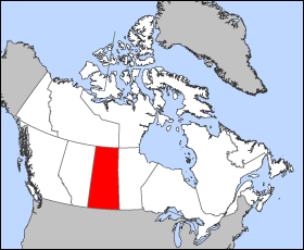
Map of Saskatchewan
Projection: Lambert azimuthal equal-area
Geospatial data from: The Atlas of Canada, The National Atlas of the United States and U.S. Geological Survey
Cartographer: John Fowler
| 我,此作品的版權所有人,釋出此作品至公共領域。此授權條款在全世界均適用。 這可能在某些國家不合法,如果是的話: 我授予任何人有權利使用此作品於任何用途,除受法律約束外,不受任何限制。 |
Tóng-àn le̍k-sú
Chhi̍h ji̍t-kî/sî-kan, khoàⁿ hit sî-chūn--ê tóng-àn.
| Ji̍t-kî/Sî-kan | Sáuk-liŏk-dù | Chióh-cháung | Iōng-chiá | Chù-kái | |
|---|---|---|---|---|---|
| hiān-chāi | 2005-nî 3-goe̍h 24-ji̍t (pài-sì) 12:18 | | 280 × 230(15 KB) | Voyager | Map of Saskatchewan Projection: Lambert azimuthal equal-area Geospatial data from: [http://atlas.gc.ca/ The Atlas of Canada], [http://www.nationalatlas.gov/ The National Atlas of the United States] and [http://www.usgs.gov U.S. Geological Survey] Carto |
Iáⁿ-siōng liân-kiat
Í-hā ê ia̍h liân kàu chit ê iáⁿ-siōng:
tóng-àn hō͘ lâng sái--ê chōng-hóng
Ē-kha--ê kî-thaⁿ wiki ēng tio̍h chit--ê tóng-àn:
- bat-smg.wikipedia.org hō͘ lâng ēng--ê chêng-hêng
- br.wikipedia.org hō͘ lâng ēng--ê chêng-hêng
- en.wikipedia.org hō͘ lâng ēng--ê chêng-hêng
- en.wiktionary.org hō͘ lâng ēng--ê chêng-hêng
- eo.wikipedia.org hō͘ lâng ēng--ê chêng-hêng
- frr.wikipedia.org hō͘ lâng ēng--ê chêng-hêng
- gd.wikipedia.org hō͘ lâng ēng--ê chêng-hêng
- hu.wikipedia.org hō͘ lâng ēng--ê chêng-hêng
- hu.wiktionary.org hō͘ lâng ēng--ê chêng-hêng
- io.wikipedia.org hō͘ lâng ēng--ê chêng-hêng
- kw.wikipedia.org hō͘ lâng ēng--ê chêng-hêng
- lij.wikipedia.org hō͘ lâng ēng--ê chêng-hêng
- nn.wikipedia.org hō͘ lâng ēng--ê chêng-hêng
- pam.wikipedia.org hō͘ lâng ēng--ê chêng-hêng
- pms.wikipedia.org hō͘ lâng ēng--ê chêng-hêng
- sc.wikipedia.org hō͘ lâng ēng--ê chêng-hêng
- sh.wikipedia.org hō͘ lâng ēng--ê chêng-hêng
- ta.wikipedia.org hō͘ lâng ēng--ê chêng-hêng
- uk.wikipedia.org hō͘ lâng ēng--ê chêng-hêng
- vo.wikipedia.org hō͘ lâng ēng--ê chêng-hêng
- wa.wikipedia.org hō͘ lâng ēng--ê chêng-hêng
- xmf.wikipedia.org hō͘ lâng ēng--ê chêng-hêng