
La Chapelle-de-Surieu
| La Chapelle-de-Surieu | |
| — Commune — | |
 La Chapelle-de-Surieu ê kéng-sek
|
|
 |
|
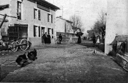
 La Chapelle-de-Surieu |
|
| Keng-hūi-tō͘: 45°23′28″N 4°54′36″E / 45.39111°N 4.91000°E | |
| Kok-ka | |
|---|---|
| Toā-khu | Rhône-Alpes |
| Koān | Isère |
| Kūn | |
La Chapelle-de-Surieu sī ūi-tī Hoat-kok Rhône-Alpes toā-khu Isère séng ê chi̍t ê commune.
Tē-lí[siu-kái | kái goân-sí-bé]
Tī La Chapelle-de-Surieu ê sì-ûi ū Saint-Romain-de-Surieu, Sonnay, Assieu, Bellegarde-Poussieu, kap Montseveroux téng siâⁿ-chhī he̍k-chiá chng-siā.
Jîn-kháu[siu-kái | kái goân-sí-bé]
| Nî-tō͘ | 1968 | 1975 | 1982 | 1990 | 1999 | 2007 | 2012 |
|---|---|---|---|---|---|---|---|
| Jîn-kháu | 345 | 289 | 326 | 409 | 477 | 632 | 712 |
| Bi̍t-tō͘ (jîn-kháu/km²) | 30.7 | 25.8 | 29.1 | 36.5 | 42.5 | 56.3 | 63.5 |
Chham-khó[siu-kái | kái goân-sí-bé]
- "Commune de La Chapelle-de-Surieu (38077) - Dossier complet". INSEE. 2016-05-22 khòaⁿ--ê.
Liân-kiat[siu-kái | kái goân-sí-bé]