
tóng-àn:Downtown Appalachia, Virginia.jpg
Choân kái-sek-tō͘ (1,300 × 1,148 siōng-sò͘ , tóng-àn chiàm-liōng: 947 KB, MIME luī-hêng: image/jpeg)
|
|
Che sī tùi Wikimedia Commons ín--lâi ê chi̍t hūn tóng-àn. I tī hia ê kì-su̍t-ia̍h téng-bīn ê chu-sìn hián-sī ùi ē-té. |
| Soat-bêng |
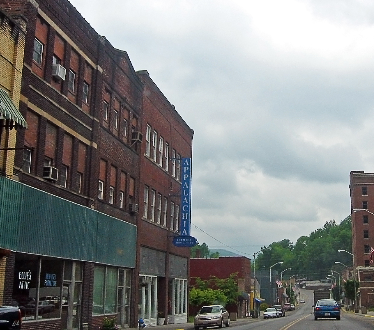
I'm going through photos from last year's trip to Appalachia, to supplement my writing up of the roadtrip tale on my blog. This is a rather poor snapshot, through the car window, of downtown Appalachia, a small town in southwestern Virginia. Since my roadtrip was to Appalachia, the region, I felt compelled to take the route to the Cumberland Gap that went through Appalachia, the town. I prefer small roads to large anyway, so I skipped the highway from Norton to Big Stone Gap, instead taking the smaller road to Appalachia, and then an even smaller road to Pennington Gap by way of Keokee. I'm still strangely pleased that there is a town called Appalachia. The region was very clearly a coal-mining area -- the only such area I saw during my trip to Appalachia (the region). Coal is important in the central and northern part of the Appalachians, and the town of Appalachia was about as far north as I got, so I saw very little coal, save in this part of Virginia. Here's a link to a map of Appalachia on MS Local Live. I hope it works. |
| Ji̍t-kî | |
| Chhut-chhù | Appalachia, the town |
| Chok-chiá | pfly from Pugetopolis |
| 拍攝地點 | | 位於此地的本圖片與其他圖片: OpenStreetMap |
|---|
Siū-khoân
- 你會使自由:
- 分享 – kho͘-pih, hoat-pò͘ kap thoân-pò͘ pún chok
- 重新修改 – kái-pian pún chok-phín
- Àn i-hā ê tiâu-kiāⁿ
- 標示名姓 – 您必須指名出正確的製作者,和提供授權條款的連結,以及表示是否有對內容上做出變更。您可以用任何合理的方式來行動,但不得以任何方式表明授權條款是對您許可或是由您所使用。
- 仝款方式方享 – Lí nā kái-tōng, piàn-khoán, he̍k-chiá kun-kù pún chok chhòng-chō, lí kaⁿ-taⁿ ē-tàng ēng kap pún chok kâng-khoán he̍k-chiá saⁿ-chhiūⁿ ê hí-khó lâi hoat-pò͘ chò--chhut-lâi ê chok-phín.
| 此张图片原发布于Flickr,在December 15, 2008由管理员或审查员File Upload Bot (Magnus Manske)检查后,确认检查时图片在Flickr的版权声明与维基共享资源的版权使用方针相符。 |
Tóng-àn le̍k-sú
Chhi̍h ji̍t-kî/sî-kan, khoàⁿ hit sî-chūn--ê tóng-àn.
| Ji̍t-kî/Sî-kan | Sáuk-liŏk-dù | Chióh-cháung | Iōng-chiá | Chù-kái | |
|---|---|---|---|---|---|
| hiān-chāi | 2008-nî 12-goe̍h 15-ji̍t (pài-it) 02:56 | | 1,300 × 1,148(947 KB) | File Upload Bot (Magnus Manske) | {{Information |Description= I'm going through photos from last year's trip to Appalachia, to supplement my writing up of the roadtrip tale on [http://www.pfly.net/ my blog]. This is a rather poor snapshot, through the car window, of downtown Appalachia, |
Iáⁿ-siōng liân-kiat
Í-hā ê ia̍h liân kàu chit ê iáⁿ-siōng:
tóng-àn hō͘ lâng sái--ê chōng-hóng
Ē-kha--ê kî-thaⁿ wiki ēng tio̍h chit--ê tóng-àn:
- ar.wikipedia.org hō͘ lâng ēng--ê chêng-hêng
- azb.wikipedia.org hō͘ lâng ēng--ê chêng-hêng
- ceb.wikipedia.org hō͘ lâng ēng--ê chêng-hêng
- ce.wikipedia.org hō͘ lâng ēng--ê chêng-hêng
- cy.wikipedia.org hō͘ lâng ēng--ê chêng-hêng
- es.wikipedia.org hō͘ lâng ēng--ê chêng-hêng
- fa.wikipedia.org hō͘ lâng ēng--ê chêng-hêng
- ht.wikipedia.org hō͘ lâng ēng--ê chêng-hêng
- it.wikipedia.org hō͘ lâng ēng--ê chêng-hêng
- lld.wikipedia.org hō͘ lâng ēng--ê chêng-hêng
- pl.wikipedia.org hō͘ lâng ēng--ê chêng-hêng
- pt.wikipedia.org hō͘ lâng ēng--ê chêng-hêng
- ru.wikipedia.org hō͘ lâng ēng--ê chêng-hêng
- sh.wikipedia.org hō͘ lâng ēng--ê chêng-hêng
- sr.wikipedia.org hō͘ lâng ēng--ê chêng-hêng
- tt.wikipedia.org hō͘ lâng ēng--ê chêng-hêng
- uk.wikipedia.org hō͘ lâng ēng--ê chêng-hêng
- uz.wikipedia.org hō͘ lâng ēng--ê chêng-hêng
- www.wikidata.org hō͘ lâng ēng--ê chêng-hêng