
tóng-àn:Durham UK location map.svg

此 SVG 檔案的 PNG 預覽的大小:800 × 524 siōng-sò͘。 Kî-thaⁿ--ê kái-sek-tō͘: 320 × 210 siōng-sò͘ | 640 × 419 siōng-sò͘ | 1,024 × 671 siōng-sò͘ | 1,280 × 839 siōng-sò͘ | 2,560 × 1,678 siōng-sò͘ | 1,425 × 934 siōng-sò͘.
Choân kái-sek-tō͘ (SVG ùng-giông, chék-cháung: 1,425 × 934 chuông-só, ùng-giông duâi-nâung:1.39 MB)
|
|
Che sī tùi Wikimedia Commons ín--lâi ê chi̍t hūn tóng-àn. I tī hia ê kì-su̍t-ia̍h téng-bīn ê chu-sìn hián-sī ùi ē-té. |
| Soat-bêng |
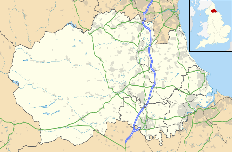
Map of County Durham, UK with the following information shown:
Equirectangular map projection on WGS 84 datum, with N/S stretched 170% Geographic limits:
|
| Ji̍t-kî | |
| Chhut-chhù |
|
| Chok-chiá | Nilfanion, created using Ordnance Survey data |
| 授權允准 (Bô siŏh-huòi sāi ciā ùng-giông) |
此檔案採用創用CC 姓名標示-相同方式分享 3.0 未在地化版本授權條款。 Biĕu-sê miàng-sáng: Contains Ordnance Survey data © Crown copyright and database right
|
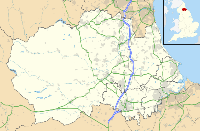
| 其他版本 | File:Durham UK district map (blank).svg - Blank map |
.svg)
Tóng-àn le̍k-sú
Chhi̍h ji̍t-kî/sî-kan, khoàⁿ hit sî-chūn--ê tóng-àn.
| Ji̍t-kî/Sî-kan | Sáuk-liŏk-dù | Chióh-cháung | Iōng-chiá | Chù-kái | |
|---|---|---|---|---|---|
| hiān-chāi | 2010-nî 9-goe̍h 26-ji̍t (lé-pài) 19:04 | | 1,425 × 934(1.39 MB) | Nilfanion | fixing dodgy layer |
| 2010-nî 9-goe̍h 26-ji̍t (lé-pài) 18:43 |  | 1,425 × 934(1.39 MB) | Nilfanion | {{Information |Description=Map of County Durham, UK with the following information shown: *Administrative borders *Coastline, lakes and rivers *Roads and railways *Urban areas Equirectangular map projection on WGS 84 datum, with N/S s |
Iáⁿ-siōng liân-kiat
Í-hā ê ia̍h liân kàu chit ê iáⁿ-siōng:
- Aislaby (Durham)
- Archdeacon Newton
- Barforth
- Barmpton
- Barnard Castle
- Barningham (Durham)
- Bearpark
- Billingham
- Bishop Auckland
- Boldron
- Bournmoor
- Bowes
- Brignall
- Burnhope
- Carlton (Durham)
- Chilton (Durham)
- Cleatlam
- Coatham Mundeville
- Cockfield (Durham)
- Cornforth
- Cotherstone
- Coxhoe
- Denton (Durham)
- Durham (Eng-lân)
- Eaglescliffe
- Easington (Durham)
- Easington Colliery
- Edmondsley
- Edmundbyers
- Egglescliffe
- Eggleston
- Esh
- Ferryhill
- Fishburn
- Framwellgate Moor
- Gainford
- Gilmonby
- Great Burdon
- Great Lumley
- Haswell (Durham)
- Hawthorn (Durham)
- Heighington (Durham)
- High Coniscliffe
- Holwick
- Horden (Durham)
- Hutton Magna
- Lartington
- Mickleton (Durham)
- Middleton-in-Teesdale
- Middridge
- Muggleswick
- Murton (Durham)
- Neasham
- Ovington (Durham)
- Peterlee
- Piercebridge
- Romaldkirk
- Sacriston
- Sadberge
- Scargill (Durham)
- Seaham
- Sedgefield (Durham)
- Shildon
- Sockburn
- South Hetton
- Spennymoor
- Staindrop
- Stanhope (Durham)
- Stanley (Durham)
- Startforth
- Summerhouse
- Tow Law
- Trimdon
- Waldridge
- Walworth (Durham)
- West Auckland
- West Rainton
- Westwick (Durham)
- Whorlton (Durham)
- Wingate (Durham)
- Winston (Durham)
- Witton-le-Wear
- Witton Gilbert
- Wolsingham
tóng-àn hō͘ lâng sái--ê chōng-hóng
Ē-kha--ê kî-thaⁿ wiki ēng tio̍h chit--ê tóng-àn:
- ar.wikipedia.org hō͘ lâng ēng--ê chêng-hêng
- azb.wikipedia.org hō͘ lâng ēng--ê chêng-hêng
- bg.wikipedia.org hō͘ lâng ēng--ê chêng-hêng
- ceb.wikipedia.org hō͘ lâng ēng--ê chêng-hêng
- en.wikipedia.org hō͘ lâng ēng--ê chêng-hêng
- Tanfield, County Durham
- Durham, England
- Barnard Castle
- Darlington
- Willington, County Durham
- Pity Me
- Chester-le-Street
- Hartlepool
- Stockton-on-Tees
- Bishop Auckland
- Seaham
- Sedgefield
- Peterlee
- Annfield Plain
- Easington, County Durham
- Consett
- Newton Aycliffe
- Catchgate
- Norton, County Durham
- Spennymoor
- Beamish Museum
- Stanley, County Durham
- Ferryhill
- Gainford, County Durham
- Billingham
- Eaglescliffe
- Ushaw College
- Lambton Castle
- No Place
- Burnhope
- Craghead
- Shotley Bridge
- Preston Hall, Preston-on-Tees
- Sacriston
- Cassop
- Teesside International Airport
- White-le-Head
- Tanfield Lea
- Quaking Houses
- South Moor
- Oxhill, County Durham
- Preston-on-Tees
- List of places in County Durham
- Lumley Castle
- East Kyo
檢視此檔案的更多全域使用狀況。