
tóng-àn:Fontaines Salees thermae 01.jpg
Seng khoàⁿ chiàm-liōng: 800 × 534 siōng-sò͘. Kî-thaⁿ--ê kái-sek-tō͘: 320 × 213 siōng-sò͘ | 640 × 427 siōng-sò͘ | 1,024 × 683 siōng-sò͘.
Choân kái-sek-tō͘ (1,024 × 683 siōng-sò͘ , tóng-àn chiàm-liōng: 211 KB, MIME luī-hêng: image/jpeg)
|
|
Che sī tùi Wikimedia Commons ín--lâi ê chi̍t hūn tóng-àn. I tī hia ê kì-su̍t-ia̍h téng-bīn ê chu-sìn hián-sī ùi ē-té. |
|
This building is indexed in the base Mérimée, a database of architectural heritage maintained by the French Ministry of Culture, under the reference PA00113837
|
| Soat-bêng |
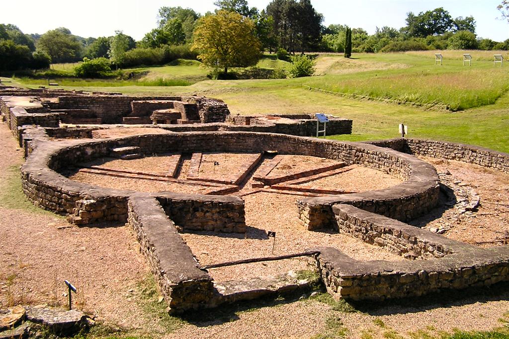
English: Fontaines Salées archeological site, shared between Saint-Père (Nièvre) and Foissy-lès-Vézelay (Yonne), Bourgogne, France. Thermae ruins, view towards the south-east. Français : Le site archéologique des Fontaines salées, à cheval entre Foissy-lès-Vézelay et le sud de la commune de Saint-Père, Yonne, Bourgogne, France. Ruines des thermes. Vue vers le sud-est. La rivière Cure coule derrière les arbres du côté gauche de la photo. |
| Ji̍t-kî | |
| Chhut-chhù | Ka-tī chò--ê |
| Chok-chiá | Emmanuel Brunner |
| 拍攝地點 | | 位於此地的本圖片與其他圖片: OpenStreetMap |
|---|
| 目標地點 | | 位於此地的本圖片與其他圖片: OpenStreetMap |
|---|
此檔案採用創用CC 姓名標示-相同方式分享 1.0 通用版授權條款。
- 你會使自由:
- 分享 – kho͘-pih, hoat-pò͘ kap thoân-pò͘ pún chok
- 重新修改 – kái-pian pún chok-phín
- Àn i-hā ê tiâu-kiāⁿ
- 標示名姓 – 您必須指名出正確的製作者,和提供授權條款的連結,以及表示是否有對內容上做出變更。您可以用任何合理的方式來行動,但不得以任何方式表明授權條款是對您許可或是由您所使用。
- 仝款方式方享 – If you alter, transform, or build upon this work, you must distribute the resulting work under the same license as the original.
原始上傳日誌
The original description page was here. All following user names refer to fr.wikipedia.
- 2006-06-18 18:04 Manu25 1024×683×8 (215780 bytes) BRUNNER Emmanuel
Tóng-àn le̍k-sú
Chhi̍h ji̍t-kî/sî-kan, khoàⁿ hit sî-chūn--ê tóng-àn.
| Ji̍t-kî/Sî-kan | Sáuk-liŏk-dù | Chióh-cháung | Iōng-chiá | Chù-kái | |
|---|---|---|---|---|---|
| hiān-chāi | 2008-nî 7-goe̍h 18-ji̍t (pài-gō·) 17:36 | | 1,024 × 683(211 KB) | Methos31 | {{Information| |Description={{fr|Ruines des thermes, Site archéologique des Fontaines Salées, Saint-Père (Yonne), France}} {{en|Thermae ruins, Fontaines Salées archeological site, Saint-Père (Yonne), France}} |Source=own work |Date=June 2006 |Author= |
Iáⁿ-siōng liân-kiat
Í-hā ê ia̍h liân kàu chit ê iáⁿ-siōng:
tóng-àn hō͘ lâng sái--ê chōng-hóng
Ē-kha--ê kî-thaⁿ wiki ēng tio̍h chit--ê tóng-àn:
- ast.wikipedia.org hō͘ lâng ēng--ê chêng-hêng
- ca.wikipedia.org hō͘ lâng ēng--ê chêng-hêng
- ce.wikipedia.org hō͘ lâng ēng--ê chêng-hêng
- de.wikipedia.org hō͘ lâng ēng--ê chêng-hêng
- el.wikipedia.org hō͘ lâng ēng--ê chêng-hêng
- en.wikipedia.org hō͘ lâng ēng--ê chêng-hêng
- es.wikipedia.org hō͘ lâng ēng--ê chêng-hêng
- eu.wikipedia.org hō͘ lâng ēng--ê chêng-hêng
- fi.wikipedia.org hō͘ lâng ēng--ê chêng-hêng
- fr.wikipedia.org hō͘ lâng ēng--ê chêng-hêng
- hu.wikipedia.org hō͘ lâng ēng--ê chêng-hêng
- it.wikipedia.org hō͘ lâng ēng--ê chêng-hêng
- ku.wikipedia.org hō͘ lâng ēng--ê chêng-hêng
- lb.wikipedia.org hō͘ lâng ēng--ê chêng-hêng
- pl.wikipedia.org hō͘ lâng ēng--ê chêng-hêng
- pt.wikipedia.org hō͘ lâng ēng--ê chêng-hêng
- ro.wikipedia.org hō͘ lâng ēng--ê chêng-hêng
- simple.wikipedia.org hō͘ lâng ēng--ê chêng-hêng
- sk.wikipedia.org hō͘ lâng ēng--ê chêng-hêng
- sv.wikipedia.org hō͘ lâng ēng--ê chêng-hêng
- tt.wikipedia.org hō͘ lâng ēng--ê chêng-hêng
- uk.wikipedia.org hō͘ lâng ēng--ê chêng-hêng
- uz.wikipedia.org hō͘ lâng ēng--ê chêng-hêng
- vec.wikipedia.org hō͘ lâng ēng--ê chêng-hêng
- www.wikidata.org hō͘ lâng ēng--ê chêng-hêng
- zh.wikipedia.org hō͘ lâng ēng--ê chêng-hêng