
tóng-àn:Map of South Africa with Cacadu highlighted (2011).svg

此 SVG 檔案的 PNG 預覽的大小:684 × 599 siōng-sò͘。 Kî-thaⁿ--ê kái-sek-tō͘: 274 × 240 siōng-sò͘ | 548 × 480 siōng-sò͘ | 876 × 768 siōng-sò͘ | 1,168 × 1,024 siōng-sò͘ | 2,337 × 2,048 siōng-sò͘ | 809 × 709 siōng-sò͘.
Choân kái-sek-tō͘ (SVG ùng-giông, chék-cháung: 809 × 709 chuông-só, ùng-giông duâi-nâung:498 KB)
|
|
Che sī tùi Wikimedia Commons ín--lâi ê chi̍t hūn tóng-àn. I tī hia ê kì-su̍t-ia̍h téng-bīn ê chu-sìn hián-sī ùi ē-té. |
.svg)
Khài-iàu
| Soat-bêng |
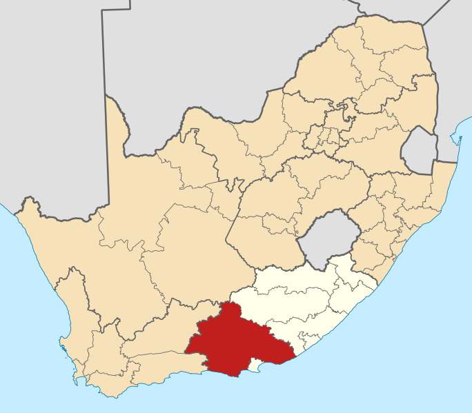
English: Map of district boundaries in South Africa, as they will be after the municipal elections of 18 May 2011, with the w:Cacadu District Municipality highlighted in red within the Eastern Cape in yellow. |
| Ji̍t-kî | |
| Chhut-chhù | Ka-tī chò--ê |
| Chok-chiá | Htonl |
Siū-khoân
我,本作品的著作權持有者,決定用以下授權條款發佈本作品:

|
已授權您依據自由軟體基金會發行的無固定段落、封面文字和封底文字GNU自由文件授權條款1.2版或任意後續版本,對本檔進行複製、傳播和/或修改。該協議的副本列在GNU自由文件授權條款中。 |
This file is licensed under the Creative Commons Attribution-Share Alike 4.0 International, 3.0 Unported, 2.5 Generic, 2.0 Generic and 1.0 Generic license.
- 你會使自由:
- 分享 – kho͘-pih, hoat-pò͘ kap thoân-pò͘ pún chok
- 重新修改 – kái-pian pún chok-phín
- Àn i-hā ê tiâu-kiāⁿ
- 標示名姓 – 您必須指名出正確的製作者,和提供授權條款的連結,以及表示是否有對內容上做出變更。您可以用任何合理的方式來行動,但不得以任何方式表明授權條款是對您許可或是由您所使用。
- 仝款方式方享 – Lí nā kái-tōng, piàn-khoán, he̍k-chiá kun-kù pún chok chhòng-chō, lí kaⁿ-taⁿ ē-tàng ēng kap pún chok kâng-khoán he̍k-chiá saⁿ-chhiūⁿ ê hí-khó lâi hoat-pò͘ chò--chhut-lâi ê chok-phín.
Nṳ̄ buóh dĭk sié-nó̤h sêu-guòng dèu-kuāng dŭ kō̤-ī gēng.
Tóng-àn le̍k-sú
Chhi̍h ji̍t-kî/sî-kan, khoàⁿ hit sî-chūn--ê tóng-àn.
| Ji̍t-kî/Sî-kan | Sáuk-liŏk-dù | Chióh-cháung | Iōng-chiá | Chù-kái | |
|---|---|---|---|---|---|
| hiān-chāi | 2011-nî 5-goe̍h 2-ji̍t (pài-it) 13:59 | | 809 × 709(498 KB) | Htonl | == Summary == {{Information |Description ={{en|1=Map of district boundaries in South Africa, as they will be after the municipal elections of 18 May 2011, with the w:Cacadu District Municipality highligh |
Iáⁿ-siōng liân-kiat
Í-hā ê ia̍h liân kàu chit ê iáⁿ-siōng:
tóng-àn hō͘ lâng sái--ê chōng-hóng
Ē-kha--ê kî-thaⁿ wiki ēng tio̍h chit--ê tóng-àn:
- af.wikipedia.org hō͘ lâng ēng--ê chêng-hêng
- Nieu-Bethesda
- Grahamstad
- Bathurst, Oos-Kaap
- Port Alfred
- Graaff-Reinet
- Aberdeen, Oos-Kaap
- Adendorp
- Somerset-Oos
- Joubertina
- Boesmansriviermond
- Humansdorp
- Willowmore
- Pearston
- Riebeek-Oos
- Jansenville
- Steytlerville
- Hankey
- Patensie
- Kookhuis
- Jeffreysbaai
- Kareedouw
- Klipplaat
- Kirkwood
- Alicedale
- Kruisfontein
- Paterson
- Stormsrivier, Oos-Kaap
- Loerie
- Kendrew
- Kenton-on-Sea
- Alexandria, Oos-Kaap
- Stormsrivier
- Addo
- Louterwater
- Krakeelrivier (dorpie)
- Salem, Oos-Kaap
- St. Francisbaai
- Clarkson
- Thornham
- Coldstream
- Rietbron
- Misgund
- Tweeriviere
- Kaap St Francis
- Oesterbaai
- Sjabloonbespreking:Suid-Afrikaanse distriksmunisipaliteit navbox
- Cannon Rocks
- Boknesstrand
- Kasouga
- Thornhill, Kouga
檢視此檔案的更多全域使用狀況。
.svg)
.svg)