
tóng-àn:Northbound entering Gorongosa District.JPG

Seng khoàⁿ chiàm-liōng: 800 × 462 siōng-sò͘. Kî-thaⁿ--ê kái-sek-tō͘: 320 × 185 siōng-sò͘ | 640 × 369 siōng-sò͘ | 1,031 × 595 siōng-sò͘.
Choân kái-sek-tō͘ (1,031 × 595 siōng-sò͘ , tóng-àn chiàm-liōng: 123 KB, MIME luī-hêng: image/jpeg)
|
|
Che sī tùi Wikimedia Commons ín--lâi ê chi̍t hūn tóng-àn. I tī hia ê kì-su̍t-ia̍h téng-bīn ê chu-sìn hián-sī ùi ē-té. |
Khài-iàu
| Soat-bêng |
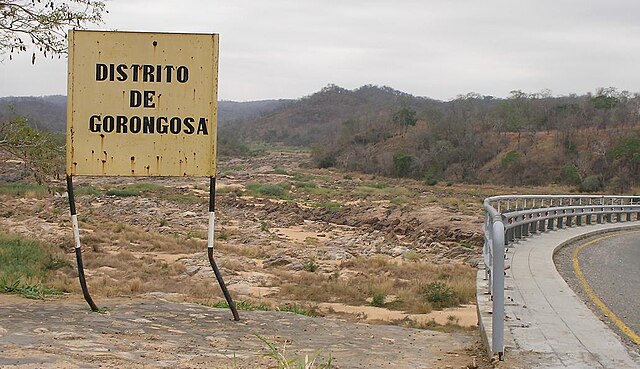
English: Travelling north on the main north-south highway of Mozambique (the EN1), entering the Gorongosa District. The bridge over the Rio Púnguè continues to the right of the photo. Note that river's low water level is typical of the late dry season. |
||
| Ji̍t-kî | |||
| Chhut-chhù | Ka-tī chò--ê | ||
| Chok-chiá | Brian Dell | ||
| 授權允准 (Bô siŏh-huòi sāi ciā ùng-giông) |
|
| 拍攝地點 | | 位於此地的本圖片與其他圖片: OpenStreetMap |
|---|
Tóng-àn le̍k-sú
Chhi̍h ji̍t-kî/sî-kan, khoàⁿ hit sî-chūn--ê tóng-àn.
| Ji̍t-kî/Sî-kan | Sáuk-liŏk-dù | Chióh-cháung | Iōng-chiá | Chù-kái | |
|---|---|---|---|---|---|
| hiān-chāi | 2008-nî 11-goe̍h 11-ji̍t (pài-jī) 08:07 | | 1,031 × 595(123 KB) | Bdell555 | {{Information |Description={{en|1=Travelling north on the main north-south highway of Mozambique, entering the Gorongosa District. The bridge continues to the right of the photo. Note that the river's low water level is typical of the late dry season.}} |
Iáⁿ-siōng liân-kiat
Í-hā ê ia̍h liân kàu chit ê iáⁿ-siōng:
tóng-àn hō͘ lâng sái--ê chōng-hóng
Ē-kha--ê kî-thaⁿ wiki ēng tio̍h chit--ê tóng-àn:
- ca.wikipedia.org hō͘ lâng ēng--ê chêng-hêng
- ceb.wikipedia.org hō͘ lâng ēng--ê chêng-hêng
- en.wikipedia.org hō͘ lâng ēng--ê chêng-hêng
- fi.wikipedia.org hō͘ lâng ēng--ê chêng-hêng
- ha.wikipedia.org hō͘ lâng ēng--ê chêng-hêng
- ig.wikipedia.org hō͘ lâng ēng--ê chêng-hêng
- no.wikipedia.org hō͘ lâng ēng--ê chêng-hêng
- pt.wikipedia.org hō͘ lâng ēng--ê chêng-hêng
- ts.wikipedia.org hō͘ lâng ēng--ê chêng-hêng
- www.wikidata.org hō͘ lâng ēng--ê chêng-hêng
- yo.wikipedia.org hō͘ lâng ēng--ê chêng-hêng
- zh.wikipedia.org hō͘ lâng ēng--ê chêng-hêng
- zu.wikipedia.org hō͘ lâng ēng--ê chêng-hêng