
tóng-àn:Northumberland UK location map.svg

此 SVG 檔案的 PNG 預覽的大小:499 × 599 siōng-sò͘。 Kî-thaⁿ--ê kái-sek-tō͘: 200 × 240 siōng-sò͘ | 400 × 480 siōng-sò͘ | 639 × 768 siōng-sò͘ | 853 × 1,024 siōng-sò͘ | 1,705 × 2,048 siōng-sò͘ | 1,120 × 1,345 siōng-sò͘.
Choân kái-sek-tō͘ (SVG ùng-giông, chék-cháung: 1,120 × 1,345 chuông-só, ùng-giông duâi-nâung:1.68 MB)
|
|
Che sī tùi Wikimedia Commons ín--lâi ê chi̍t hūn tóng-àn. I tī hia ê kì-su̍t-ia̍h téng-bīn ê chu-sìn hián-sī ùi ē-té. |
| Soat-bêng |
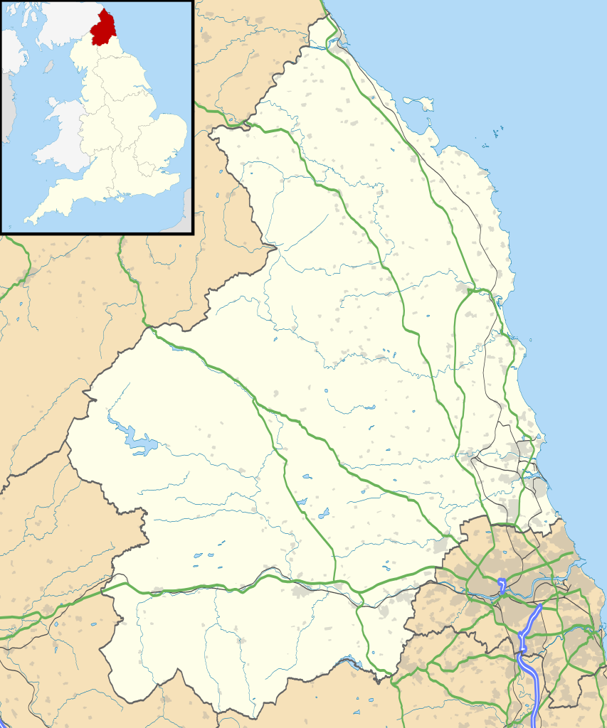
Map of Northumberland, UK with the following information shown:
Equirectangular map projection on WGS 84 datum, with N/S stretched 170% Geographic limits:
|
| Ji̍t-kî | |
| Chhut-chhù |
|
| Chok-chiá | Nilfanion, created using Ordnance Survey data |
| 授權允准 (Bô siŏh-huòi sāi ciā ùng-giông) |
此檔案採用創用CC 姓名標示-相同方式分享 3.0 未在地化版本授權條款。 Biĕu-sê miàng-sáng: Contains Ordnance Survey data © Crown copyright and database right
|
| 其他版本 | File:Northumberland UK district map (blank).svg - Blank map |
.svg)
Tóng-àn le̍k-sú
Chhi̍h ji̍t-kî/sî-kan, khoàⁿ hit sî-chūn--ê tóng-àn.
| Ji̍t-kî/Sî-kan | Sáuk-liŏk-dù | Chióh-cháung | Iōng-chiá | Chù-kái | |
|---|---|---|---|---|---|
| hiān-chāi | 2010-nî 9-goe̍h 26-ji̍t (lé-pài) 19:08 | | 1,120 × 1,345(1.68 MB) | Nilfanion | {{Information |Description=Map of Northumberland, UK with the following information shown: *Administrative borders *Coastline, lakes and rivers *Roads and railways *Urban areas Equirectangular map projection on WGS 84 datum, with N/S |
Iáⁿ-siōng liân-kiat
超過 100 個頁面有用到此檔案。 下列清單只列出前 100 筆有用到此檔案的頁面。 您也可以檢視完整清單。
- Acklington
- Acomb
- Adderstone with Lucker
- Akeld
- Allendale (Northumberland)
- Alnham
- Alnmouth
- Alnwick (Northumberland)
- Alwinton
- Amble
- Ancroft
- Ashington
- Bamburgh
- Bardon Mill
- Bavington
- Beadnell
- Belford (Northumberland)
- Bellingham (Northumberland)
- Belsay
- Berwick-upon-Tweed (Northumberland)
- Bewick
- Biddlestone
- Birtley
- Blanchland
- Blyth (Northumberland)
- Bowsden
- Branxton
- Brinkburn
- Broomhaugh and Riding
- Broomley and Stocksfield
- Bywell
- Callaly
- Capheaton
- Carham
- Cartington
- Chatton
- Chollerton
- Coanwood
- Corbridge
- Cornhill-on-Tweed
- Corsenside
- Craster
- Cresswell
- Denwick
- Doddington (Northumberland)
- Duddo
- Earle (Northumberland)
- Easington (Northumberland)
- East Chevington
- Edlingham
- Eglingham
- Ellingham (Northumberland)
- Elsdon
- Embleton (Northumberland)
- Ewart
- Falstone
- Featherstone (Northumberland)
- Felton (Northumberland)
- Ford (Northumberland)
- Glanton
- Greenhead
- Greystead
- Haltwhistle
- Harbottle
- Hartburn
- Hartleyburn
- Hauxley
- Haydon (Northumberland)
- Healey (Northumberland)
- Hebron (Northumberland)
- Heddon-on-the-Wall
- Hedgeley
- Hedley (Northumberland)
- Henshaw
- Hepple
- Hepscott
- Hexham
- Hexhamshire
- Hollinghill
- Horncliffe
- Horsley (Northumberland)
- Humshaugh
- Ilderton
- Ingram (Northumberland)
- Kielder
- Kilham (Northumberland)
- Kirknewton
- Kirkwhelpington
- Kyloe
- Lesbury
- Lilburn (Northumberland)
- Lindisfarne
- Longframlington
- Longhirst
- Longhorsley
- Longhoughton
- Lowick (Northumberland)
- Lynemouth
- Matfen
- Meldon
檢視連結到這個檔案的更多連結。
tóng-àn hō͘ lâng sái--ê chōng-hóng
Ē-kha--ê kî-thaⁿ wiki ēng tio̍h chit--ê tóng-àn:
- ar.wikipedia.org hō͘ lâng ēng--ê chêng-hêng
- bg.wikipedia.org hō͘ lâng ēng--ê chêng-hêng
- ceb.wikipedia.org hō͘ lâng ēng--ê chêng-hêng
- de.wikipedia.org hō͘ lâng ēng--ê chêng-hêng
- en.wikipedia.org hō͘ lâng ēng--ê chêng-hêng
- Churnsike Lodge
- Lindisfarne
- Bamburgh
- Berwick-upon-Tweed
- Dunstanburgh Castle
- Craster
- Embleton, Northumberland
- Alnwick
- Alnwick Castle
- Edlingham Castle
- Seahouses
- Farne Islands
- Belford, Northumberland
- Branxton, Northumberland
- Beal, Northumberland
- Prudhoe
- Corbridge
- Hexham
- Bedlington
- Rothbury
- Wooler
- Amble
- Morpeth, Northumberland
- Ancroft
- Islandshire
- Blyth, Northumberland
- Coquet Island
- Cramlington
- Newbiggin-by-the-Sea
- Fusiliers Museum of Northumberland
- Battle of Hedgeley Moor
- Kielder Forest
- Stakeford
- Hexhamshire
- Norham
- Warkworth, Northumberland
- Bamburgh Castle
- Howick house
- RAF Boulmer
- Morpeth railway station
- Ellington, Northumberland
- Etal Castle
- Seaton Delaval Hall
- Haltwhistle
- Sinderhope
- Allendale, Northumberland
檢視此檔案的更多全域使用狀況。