
tóng-àn:Txu-oclc-6557994-index-451.jpg

Seng khoàⁿ chiàm-liōng: 789 × 600 siōng-sò͘. Kî-thaⁿ--ê kái-sek-tō͘: 316 × 240 siōng-sò͘ | 632 × 480 siōng-sò͘ | 1,011 × 768 siōng-sò͘ | 1,280 × 973 siōng-sò͘ | 2,560 × 1,946 siōng-sò͘ | 5,000 × 3,800 siōng-sò͘.
Choân kái-sek-tō͘ (5,000 × 3,800 siōng-sò͘ , tóng-àn chiàm-liōng: 4.44 MB, MIME luī-hêng: image/jpeg)
|
|
Che sī tùi Wikimedia Commons ín--lâi ê chi̍t hūn tóng-àn. I tī hia ê kì-su̍t-ia̍h téng-bīn ê chu-sìn hián-sī ùi ē-té. |
Khài-iàu
| Soat-bêng |
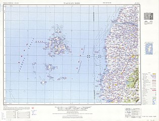
English: Tawian AMS Topographic Maps |
| Ji̍t-kî | 1950年代 |
| Chhut-chhù | Courtesy of the University of Texas Libraries, The University of Texas at Austin. ([1]) |
| Chok-chiá | Army Map Service, Corps of Engineers |
-
 Index Map

![[1]](http://legacy.lib.utexas.edu/maps/ams/taiwan/txu-oclc-6557994-nf50-4-450.jpg)
Siū-khoân
This image or file is a work of a U.S. Army Corps of Engineers soldier or employee, taken or made as part of that person's official duties. As a work of the U.S. federal government, the image is in the public domain.
|
Tóng-àn le̍k-sú
Chhi̍h ji̍t-kî/sî-kan, khoàⁿ hit sî-chūn--ê tóng-àn.
| Ji̍t-kî/Sî-kan | 細張圖 | 寸尺 | Iōng-chiá | Chù-kái | |
|---|---|---|---|---|---|
| hiān-chāi | 2019-nî 9-goe̍h 13-ji̍t (pài-gō·) 07:18 | | 5,000 × 3,800(4.44 MB) | Geographyinitiative | User created page with UploadWizard |
Iáⁿ-siōng liân-kiat
Bô poàⁿ ia̍h liân kàu chit tiuⁿ iáⁿ-siōng.
tóng-àn hō͘ lâng sái--ê chōng-hóng
Ē-kha--ê kî-thaⁿ wiki ēng tio̍h chit--ê tóng-àn:
- en.wikipedia.org hō͘ lâng ēng--ê chêng-hêng
- Penghu
- Magong
- Chiayi
- Sinhua District
- Puzi
- Xinying District
- Qimei
- Madou District
- Huxi, Penghu
- Baisha, Penghu
- Zuojhen District
- Wangan, Penghu
- Beigang, Yunlin
- Tainan
- Kouhu
- Shuilin
- Xiyu, Penghu
- Jibei Island
- Mudou Island
- Gupo Island
- Yuanbei Island
- Xianjiao Island
- West District, Chiayi
- East District, Chiayi
- Penghu Channel
- Hua Islet
- Hujing Island
- Dongji Island
- Tongpan Island
- en.wiktionary.org hō͘ lâng ēng--ê chêng-hêng
- fr.wikipedia.org hō͘ lâng ēng--ê chêng-hêng
- he.wikipedia.org hō͘ lâng ēng--ê chêng-hêng
- hy.wikipedia.org hō͘ lâng ēng--ê chêng-hêng
- zh.wikipedia.org hō͘ lâng ēng--ê chêng-hêng