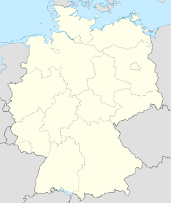
"Oesterwurth" pán-pún chi-kan bô-kāng--ê tē-hng
刪去的內容 新增的內容
~ →top: thiⁿ pang-bô͘ |
~ →top: thiⁿ pang-bô͘ chu-liāu |
||
| Tē 16 chōa: | Tē 16 chōa: | ||
|population_total = |
|population_total = |
||
|elevation_m = |
|elevation_m = |
||
|pushpin_map = |
|pushpin_map = Germany |
||
|pushpin_label_position = bottom |
|pushpin_label_position = bottom |
||
|latd = |
|latd = 54 |
||
|latm = |
|latm = 13 |
||
|lats = |
|lats = |
||
|latNS = N |
|latNS = N |
||
|longd = |
|longd = 8 |
||
|longm = |
|longm = 59 |
||
|longs = |
|longs = |
||
|longEW = E |
|longEW = E |
||
2020-nî 10-goe̍h 11-ji̍t (lé-pài) 17:20 ê siu-tēng-pún
| Oesterwurth | |
| — Kong-siā — | |
| Keng-hūi-tō͘: 54°13′N 8°59′E / 54.217°N 8.983°E | |
| Kok-ka | |
|---|---|
| Liân-pang-chiu | Schleswig-Holstein |
| Kūn | Dithmarschen |
| Sî-khu | CET (UTC+1) |
| - Jo̍at--lâng | CEST (UTC+2) |
Oesterwurth sī Tek-kok Schleswig-Holstein Chiu Dithmarschen Kūn ê chi̍t ê kong-siā (Gemeinde).[1]
Chham-oa̍t
Chham-khó
- ↑ "Statistikamt Nord – Bevölkerung der Gemeinden in Schleswig-Holstein 4. Quartal 2019 (XLS-file)", Statistisches Amt für Hamburg und Schleswig-Holstein.

