
tóng-àn:Andorra topographic map-en.svg

此 SVG 檔案的 PNG 預覽的大小:750 × 600 siōng-sò͘。 Kî-thaⁿ--ê kái-sek-tō͘: 300 × 240 siōng-sò͘ | 600 × 480 siōng-sò͘ | 960 × 768 siōng-sò͘ | 1,280 × 1,024 siōng-sò͘ | 2,560 × 2,048 siōng-sò͘ | 1,625 × 1,300 siōng-sò͘.
Choân kái-sek-tō͘ (SVG ùng-giông, chék-cháung: 1,625 × 1,300 chuông-só, ùng-giông duâi-nâung:1.56 MB)
|
|
Che sī tùi Wikimedia Commons ín--lâi ê chi̍t hūn tóng-àn. I tī hia ê kì-su̍t-ia̍h téng-bīn ê chu-sìn hián-sī ùi ē-té. |
Khài-iàu
| Soat-bêng |
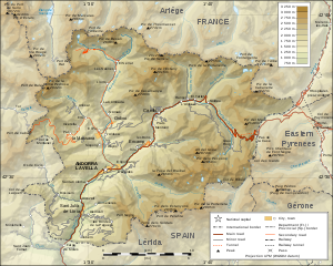
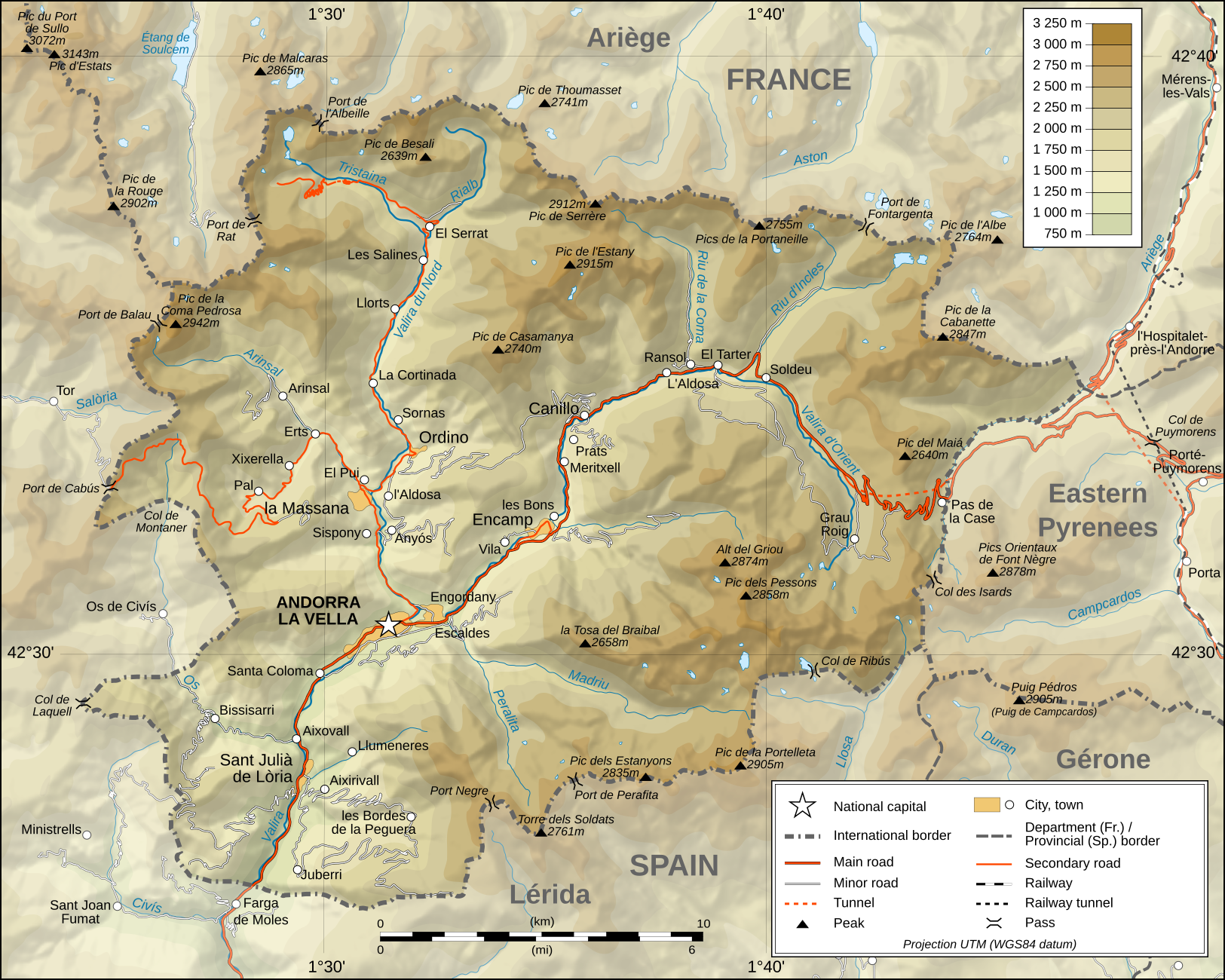
Deutsch: Topographische Karte von Andorra, englische Version English: Topographic map of Andorra Français : Carte topographique en anglais de l'Andorre |
| Ji̍t-kî | February 2008 (translation March 2009) |
| Chhut-chhù |
English: Own work ; Topographic data from the NASA Shuttle Radar Topography Mission (SRTM3 v.2) (public domain) edited with 3DEM and dlgv32 Pro and vectorized with Inkscape ; UTM projection ; WGS84 datum ; shaded relief (composite image of N-W, W and N lightning positions) ; Reference used for the additional data : * Topographic maps available on the site of the Ministeri d'Urbanisme i Ordenament Territorial of Andorra ; * Géoportail France ; Approximate scale of topographic data : 1:400,000 (accuracy : about 100 m) ; Note : The shaded relief is a raster image embedded in the SVG file. Français : Création personnelle ; Données topographiques de la NASA Shuttle Radar Topography Mission (SRTM3 v.2) (domaine public) éditées avec 3DEM et dlgv32 Pro et vectorisées avec Inkscape ; projection UTM ; WGS84 datum ; relief ombré (image composite d'éclairages du N-O, O et N) ; Références utilisées pour les données complémentaires : * Cartes topographiques disponibles sur le site du Ministeri d'Urbanisme i Ordenament Territorial d'Andorre ; * Géoportail France ; Échelle approximative des données topographiques : 1:400 000 (précision : environ 100 m) ; Note : Le relief ombré est une image bitmap embarquée dans le fichier SVG. Approximate geographic limits of the map (3" close) : * SW corner : 42°24'30"N – 01°22'40"E * SE corner : 42°24'30"N – 01°50'20"E * NE corner : 42°40'55"N – 01°50'25"E * NW corner : 42°40'55"N – 01°22'35"E |
| Chok-chiá | Eric Gaba (Sting - fr:Sting), English translation: User:Goldsztajn |
| 授權允准 (Bô siŏh-huòi sāi ciā ùng-giông) |
GFDL / Attribution and Share-Alike required |
| 其他版本 |
[]
|


|
This SVG file contains embedded text that can be translated into your language, using any capable SVG editor, text editor or the SVG Translate tool. For more information see: About translating SVG files. |
Siū-khoân
我,本作品的著作權持有者,決定用以下授權條款發佈本作品:

|
已授權您依據自由軟體基金會發行的無固定段落、封面文字和封底文字GNU自由文件授權條款1.2版或任意後續版本,對本檔進行複製、傳播和/或修改。該協議的副本列在GNU自由文件授權條款中。 |
此檔案採用創用CC 姓名標示-相同方式分享 3.0 未在地化版本授權條款。
- 你會使自由:
- 分享 – kho͘-pih, hoat-pò͘ kap thoân-pò͘ pún chok
- 重新修改 – kái-pian pún chok-phín
- Àn i-hā ê tiâu-kiāⁿ
- 標示名姓 – 您必須指名出正確的製作者,和提供授權條款的連結,以及表示是否有對內容上做出變更。您可以用任何合理的方式來行動,但不得以任何方式表明授權條款是對您許可或是由您所使用。
- 仝款方式方享 – Lí nā kái-tōng, piàn-khoán, he̍k-chiá kun-kù pún chok chhòng-chō, lí kaⁿ-taⁿ ē-tàng ēng kap pún chok kâng-khoán he̍k-chiá saⁿ-chhiūⁿ ê hí-khó lâi hoat-pò͘ chò--chhut-lâi ê chok-phín.
Nṳ̄ buóh dĭk sié-nó̤h sêu-guòng dèu-kuāng dŭ kō̤-ī gēng.
Tóng-àn le̍k-sú
Chhi̍h ji̍t-kî/sî-kan, khoàⁿ hit sî-chūn--ê tóng-àn.
| Ji̍t-kî/Sî-kan | 細張圖 | 寸尺 | Iōng-chiá | Chù-kái | |
|---|---|---|---|---|---|
| hiān-chāi | 2009-nî 3-goe̍h 30-ji̍t (pài-it) 01:34 | | 1,625 × 1,300(1.56 MB) | Goldsztajn | {{Information |Description={{en|1=Map of Andorra}} |Source=http://commons.wikimedia.org/wiki/File:Andorra_topographic_map-fr.svg |Author=User:Sting fr:Utilisateur:Sting, english translation |Date=2009-03-30 |Permission= |other_versions= }} <!--{{ |
Iáⁿ-siōng liân-kiat
Í-hā ê ia̍h liân kàu chit ê iáⁿ-siōng:
tóng-àn hō͘ lâng sái--ê chōng-hóng
Ē-kha--ê kî-thaⁿ wiki ēng tio̍h chit--ê tóng-àn:
- af.wikipedia.org hō͘ lâng ēng--ê chêng-hêng
- ar.wikipedia.org hō͘ lâng ēng--ê chêng-hêng
- azb.wikipedia.org hō͘ lâng ēng--ê chêng-hêng
- bn.wikipedia.org hō͘ lâng ēng--ê chêng-hêng
- el.wikipedia.org hō͘ lâng ēng--ê chêng-hêng
- en.wikipedia.org hō͘ lâng ēng--ê chêng-hêng
- fa.wikipedia.org hō͘ lâng ēng--ê chêng-hêng
- fi.wikipedia.org hō͘ lâng ēng--ê chêng-hêng
- ga.wikipedia.org hō͘ lâng ēng--ê chêng-hêng
- gl.wikipedia.org hō͘ lâng ēng--ê chêng-hêng
- hr.wiktionary.org hō͘ lâng ēng--ê chêng-hêng
- id.wikipedia.org hō͘ lâng ēng--ê chêng-hêng
- is.wikipedia.org hō͘ lâng ēng--ê chêng-hêng
- ka.wikipedia.org hō͘ lâng ēng--ê chêng-hêng
- lt.wikipedia.org hō͘ lâng ēng--ê chêng-hêng
- ms.wikipedia.org hō͘ lâng ēng--ê chêng-hêng
- pnb.wikipedia.org hō͘ lâng ēng--ê chêng-hêng
- ro.wikipedia.org hō͘ lâng ēng--ê chêng-hêng
- ru.wikipedia.org hō͘ lâng ēng--ê chêng-hêng
- sv.wikipedia.org hō͘ lâng ēng--ê chêng-hêng
- te.wikipedia.org hō͘ lâng ēng--ê chêng-hêng
- trv.wikipedia.org hō͘ lâng ēng--ê chêng-hêng
- uk.wikipedia.org hō͘ lâng ēng--ê chêng-hêng
- vep.wikipedia.org hō͘ lâng ēng--ê chêng-hêng
- vi.wikipedia.org hō͘ lâng ēng--ê chêng-hêng
- www.wikidata.org hō͘ lâng ēng--ê chêng-hêng
- zh.wikipedia.org hō͘ lâng ēng--ê chêng-hêng