
tóng-àn:Fields at Legionville.jpg

Seng khoàⁿ chiàm-liōng: 800 × 600 siōng-sò͘. Kî-thaⁿ--ê kái-sek-tō͘: 320 × 240 siōng-sò͘ | 640 × 480 siōng-sò͘ | 1,024 × 768 siōng-sò͘ | 1,280 × 960 siōng-sò͘ | 2,560 × 1,920 siōng-sò͘ | 2,816 × 2,112 siōng-sò͘.
Choân kái-sek-tō͘ (2,816 × 2,112 siōng-sò͘ , tóng-àn chiàm-liōng: 2.58 MB, MIME luī-hêng: image/jpeg)
|
|
Che sī tùi Wikimedia Commons ín--lâi ê chi̍t hūn tóng-àn. I tī hia ê kì-su̍t-ia̍h téng-bīn ê chu-sìn hián-sī ùi ē-té. |
| 拍攝地點 | | 位於此地的本圖片與其他圖片: OpenStreetMap |
|---|
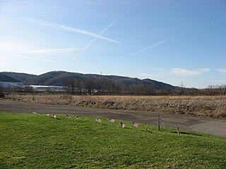
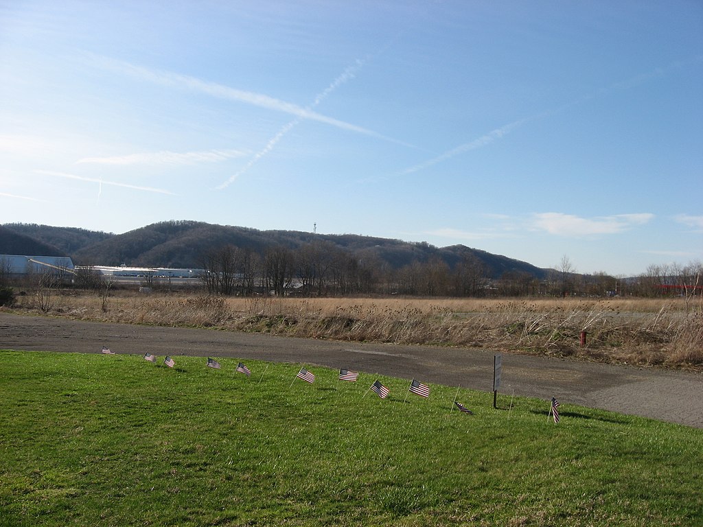
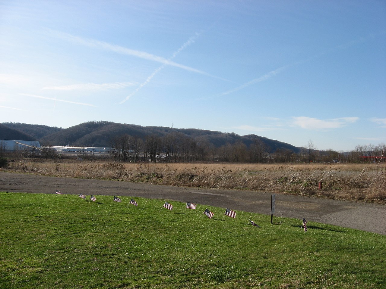
| Soat-bêng | Looking northwest across fields at the southern end of the site of Legionville, the first active training site for the United States Army under Anthony Wayne. Located along Duss Avenue in Harmony Township, Beaver County, Pennsylvania, United States, the site is listed on the National Register of Historic Places. | ||
| Ji̍t-kî | 攝於2009年4-goe̍h1日 | ||
| Chhut-chhù | Ka-tī chò--ê | ||
| Chok-chiá | Nyttend | ||
| 授權允准 (Bô siŏh-huòi sāi ciā ùng-giông) |
|
||
| 其他版本 |
 Monument at the site Monument at the site |
Tóng-àn le̍k-sú
Chhi̍h ji̍t-kî/sî-kan, khoàⁿ hit sî-chūn--ê tóng-àn.
| Ji̍t-kî/Sî-kan | 細張圖 | 寸尺 | Iōng-chiá | Chù-kái | |
|---|---|---|---|---|---|
| hiān-chāi | 2009-nî 4-goe̍h 2-ji̍t (pài-sì) 20:27 | | 2,816 × 2,112(2.58 MB) | Nyttend | {{Location|40|37|22.116|N|80|13|35.58|W}} {{Information |Description=Looking northwest across fields at the southern end of the site of {{w|Legionville}}, the first active training site for the {{w|United States Army}} under {{w|Anthony Wayne}}. Located |
Iáⁿ-siōng liân-kiat
Í-hā ê ia̍h liân kàu chit ê iáⁿ-siōng:
tóng-àn hō͘ lâng sái--ê chōng-hóng
Ē-kha--ê kî-thaⁿ wiki ēng tio̍h chit--ê tóng-àn:
- ca.wikipedia.org hō͘ lâng ēng--ê chêng-hêng
- ceb.wikipedia.org hō͘ lâng ēng--ê chêng-hêng
- cy.wikipedia.org hō͘ lâng ēng--ê chêng-hêng
- en.wikipedia.org hō͘ lâng ēng--ê chêng-hêng
- Harmony Township, Beaver County, Pennsylvania
- Legionville
- User talk:Mvincec
- National Register of Historic Places listings in Beaver County, Pennsylvania
- User:Nyttend/Pennsylvania RA
- List of European archaeological sites on the National Register of Historic Places in Pennsylvania
- List of Pennsylvania state historical markers in Beaver County
- User talk:Dthomsen8/List PA Test
- es.wikipedia.org hō͘ lâng ēng--ê chêng-hêng
- eu.wikipedia.org hō͘ lâng ēng--ê chêng-hêng
- fa.wikipedia.org hō͘ lâng ēng--ê chêng-hêng
- fr.wikipedia.org hō͘ lâng ēng--ê chêng-hêng
- it.wikipedia.org hō͘ lâng ēng--ê chêng-hêng
- pt.wikipedia.org hō͘ lâng ēng--ê chêng-hêng
- sh.wikipedia.org hō͘ lâng ēng--ê chêng-hêng
- sr.wikipedia.org hō͘ lâng ēng--ê chêng-hêng
- tl.wikipedia.org hō͘ lâng ēng--ê chêng-hêng
- tr.wikipedia.org hō͘ lâng ēng--ê chêng-hêng
- uk.wikipedia.org hō͘ lâng ēng--ê chêng-hêng
- ur.wikipedia.org hō͘ lâng ēng--ê chêng-hêng
- uz.wikipedia.org hō͘ lâng ēng--ê chêng-hêng
- vi.wikipedia.org hō͘ lâng ēng--ê chêng-hêng
- www.wikidata.org hō͘ lâng ēng--ê chêng-hêng