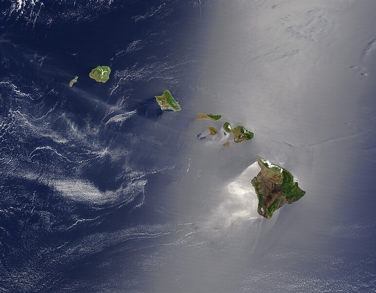
tóng-àn:Hawaje.jpg

Seng khoàⁿ chiàm-liōng: 771 × 600 siōng-sò͘. Kî-thaⁿ--ê kái-sek-tō͘: 309 × 240 siōng-sò͘ | 617 × 480 siōng-sò͘ | 988 × 768 siōng-sò͘ | 1,280 × 996 siōng-sò͘ | 2,560 × 1,991 siōng-sò͘ | 3,600 × 2,800 siōng-sò͘.
Choân kái-sek-tō͘ (3,600 × 2,800 siōng-sò͘ , tóng-àn chiàm-liōng: 1.16 MB, MIME luī-hêng: image/jpeg)
Tóng-àn le̍k-sú
Chhi̍h ji̍t-kî/sî-kan, khoàⁿ hit sî-chūn--ê tóng-àn.
| Ji̍t-kî/Sî-kan | 細張圖 | 寸尺 | Iōng-chiá | Chù-kái | |
|---|---|---|---|---|---|
| hiān-chāi | 2005-nî 10-goe̍h 26-ji̍t (pài-saⁿ) 18:19 |  | 3,600 × 2,800(1.16 MB) | Palladinus | Hawaii Islands |
Iáⁿ-siōng liân-kiat
Bô poàⁿ ia̍h liân kàu chit tiuⁿ iáⁿ-siōng.
tóng-àn hō͘ lâng sái--ê chōng-hóng
Ē-kha--ê kî-thaⁿ wiki ēng tio̍h chit--ê tóng-àn:
- arz.wikipedia.org hō͘ lâng ēng--ê chêng-hêng
- bg.wikipedia.org hō͘ lâng ēng--ê chêng-hêng
- ceb.wikipedia.org hō͘ lâng ēng--ê chêng-hêng
- co.wikipedia.org hō͘ lâng ēng--ê chêng-hêng
- en.wikipedia.org hō͘ lâng ēng--ê chêng-hêng
- es.wikipedia.org hō͘ lâng ēng--ê chêng-hêng
- fr.wikipedia.org hō͘ lâng ēng--ê chêng-hêng
- fr.wiktionary.org hō͘ lâng ēng--ê chêng-hêng
- gcr.wikipedia.org hō͘ lâng ēng--ê chêng-hêng
- gl.wikipedia.org hō͘ lâng ēng--ê chêng-hêng
- hr.wikipedia.org hō͘ lâng ēng--ê chêng-hêng
- ky.wikipedia.org hō͘ lâng ēng--ê chêng-hêng
- lv.wikipedia.org hō͘ lâng ēng--ê chêng-hêng
- no.wikipedia.org hō͘ lâng ēng--ê chêng-hêng
- oc.wikipedia.org hō͘ lâng ēng--ê chêng-hêng
- pdc.wikipedia.org hō͘ lâng ēng--ê chêng-hêng
- pl.wikipedia.org hō͘ lâng ēng--ê chêng-hêng
- pl.wiktionary.org hō͘ lâng ēng--ê chêng-hêng
- ro.wikipedia.org hō͘ lâng ēng--ê chêng-hêng
- ru.wikipedia.org hō͘ lâng ēng--ê chêng-hêng
- ru.wikinews.org hō͘ lâng ēng--ê chêng-hêng
- sq.wikipedia.org hō͘ lâng ēng--ê chêng-hêng
- sw.wikipedia.org hō͘ lâng ēng--ê chêng-hêng
- to.wikipedia.org hō͘ lâng ēng--ê chêng-hêng
- uk.wikipedia.org hō͘ lâng ēng--ê chêng-hêng


