
tóng-àn:Japan Relief Map of Land and Seabed.png
Seng khoàⁿ chiàm-liōng: 727 × 599 siōng-sò͘. Kî-thaⁿ--ê kái-sek-tō͘: 291 × 240 siōng-sò͘ | 582 × 480 siōng-sò͘ | 932 × 768 siōng-sò͘ | 1,242 × 1,024 siōng-sò͘ | 2,117 × 1,745 siōng-sò͘.
Choân kái-sek-tō͘ (2,117 × 1,745 siōng-sò͘ , tóng-àn chiàm-liōng: 7.47 MB, MIME luī-hêng: image/png)
|
|
Che sī tùi Wikimedia Commons ín--lâi ê chi̍t hūn tóng-àn. I tī hia ê kì-su̍t-ia̍h téng-bīn ê chu-sìn hián-sī ùi ē-té. |
Khài-iàu
| Soat-bêng |
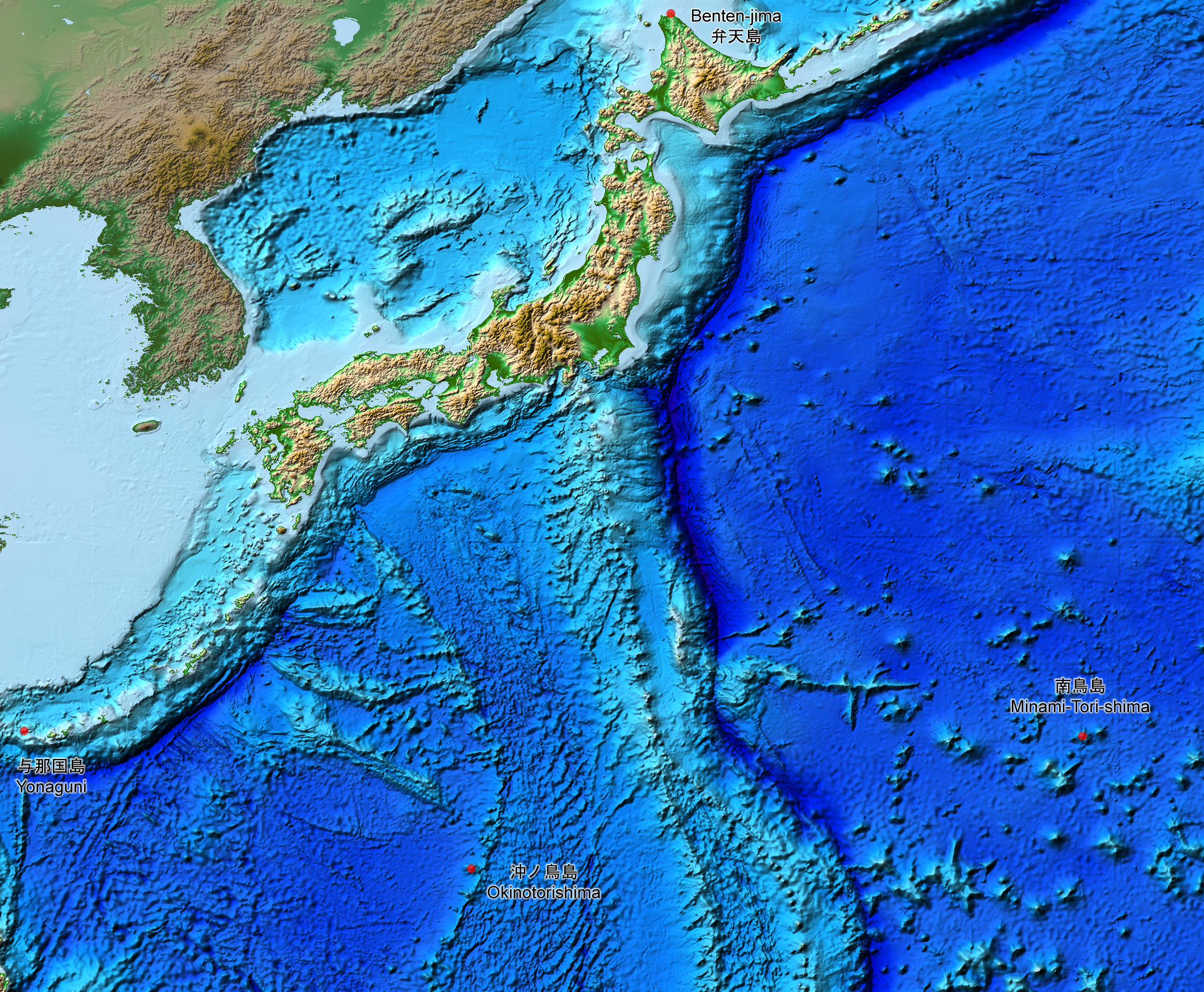
English: This is a relief map of the land and the seabed of Japan. It shows the surface and underwater terrain of the Japanese archipelago. It includes all the Japanese islands such as Minami-Tori-Shima, Benten-jima, Okinotorishima and Yonaguni.
日本語: 日本近海海底地形図と日本列島。 |
| Ji̍t-kî | |
| Chhut-chhù | ETOPO1, Global Relief Model, https://www.ngdc.noaa.gov/mgg/global/global.html |
| Chok-chiá | NASA, National Geophysical Data Center, NOAA |
Siū-khoân
| 本作品由NASA創作,屬於公有領域。根據NASA的版權政策:“NASA的創作除非另有聲明否則不受版權保護。”(參見:Template:PD-USGov/zh,NASA版權政策或JPL圖像使用政策) | ||
 |
警告:
|
Tóng-àn le̍k-sú
Chhi̍h ji̍t-kî/sî-kan, khoàⁿ hit sî-chūn--ê tóng-àn.
| Ji̍t-kî/Sî-kan | 細張圖 | 寸尺 | Iōng-chiá | Chù-kái | |
|---|---|---|---|---|---|
| hiān-chāi | 2019-nî 8-goe̍h 5-ji̍t (pài-it) 15:07 | | 2,117 × 1,745(7.47 MB) | Artanisen | The continent geography is darker to highlight the Japanese archipelago. |
| 2019-nî 7-goe̍h 22-ji̍t (pài-it) 06:29 |  | 2,117 × 1,745(7.54 MB) | Artanisen | User created page with UploadWizard |
Iáⁿ-siōng liân-kiat
Í-hā ê ia̍h liân kàu chit ê iáⁿ-siōng:
tóng-àn hō͘ lâng sái--ê chōng-hóng
Ē-kha--ê kî-thaⁿ wiki ēng tio̍h chit--ê tóng-àn:
- ar.wikipedia.org hō͘ lâng ēng--ê chêng-hêng
- ast.wikipedia.org hō͘ lâng ēng--ê chêng-hêng
- be.wikipedia.org hō͘ lâng ēng--ê chêng-hêng
- ca.wikipedia.org hō͘ lâng ēng--ê chêng-hêng
- de.wikipedia.org hō͘ lâng ēng--ê chêng-hêng
- en.wikipedia.org hō͘ lâng ēng--ê chêng-hêng
- es.wikipedia.org hō͘ lâng ēng--ê chêng-hêng
- fr.wikipedia.org hō͘ lâng ēng--ê chêng-hêng
- id.wikipedia.org hō͘ lâng ēng--ê chêng-hêng
- it.wikipedia.org hō͘ lâng ēng--ê chêng-hêng
- ja.wikipedia.org hō͘ lâng ēng--ê chêng-hêng
- min.wikipedia.org hō͘ lâng ēng--ê chêng-hêng
- pnb.wikipedia.org hō͘ lâng ēng--ê chêng-hêng
- pt.wikipedia.org hō͘ lâng ēng--ê chêng-hêng
- ru.wikipedia.org hō͘ lâng ēng--ê chêng-hêng
- sl.wikipedia.org hō͘ lâng ēng--ê chêng-hêng
- sr.wikipedia.org hō͘ lâng ēng--ê chêng-hêng
- tl.wikipedia.org hō͘ lâng ēng--ê chêng-hêng
- uk.wikipedia.org hō͘ lâng ēng--ê chêng-hêng
- vi.wikipedia.org hō͘ lâng ēng--ê chêng-hêng
- www.wikidata.org hō͘ lâng ēng--ê chêng-hêng
- zh.wikipedia.org hō͘ lâng ēng--ê chêng-hêng