
tóng-àn:Norton Malreward.jpg
Choân kái-sek-tō͘ (3,888 × 2,592 siōng-sò͘ , tóng-àn chiàm-liōng: 6.14 MB, MIME luī-hêng: image/jpeg)
|
|
Che sī tùi Wikimedia Commons ín--lâi ê chi̍t hūn tóng-àn. I tī hia ê kì-su̍t-ia̍h téng-bīn ê chu-sìn hián-sī ùi ē-té. |
| Soat-bêng |
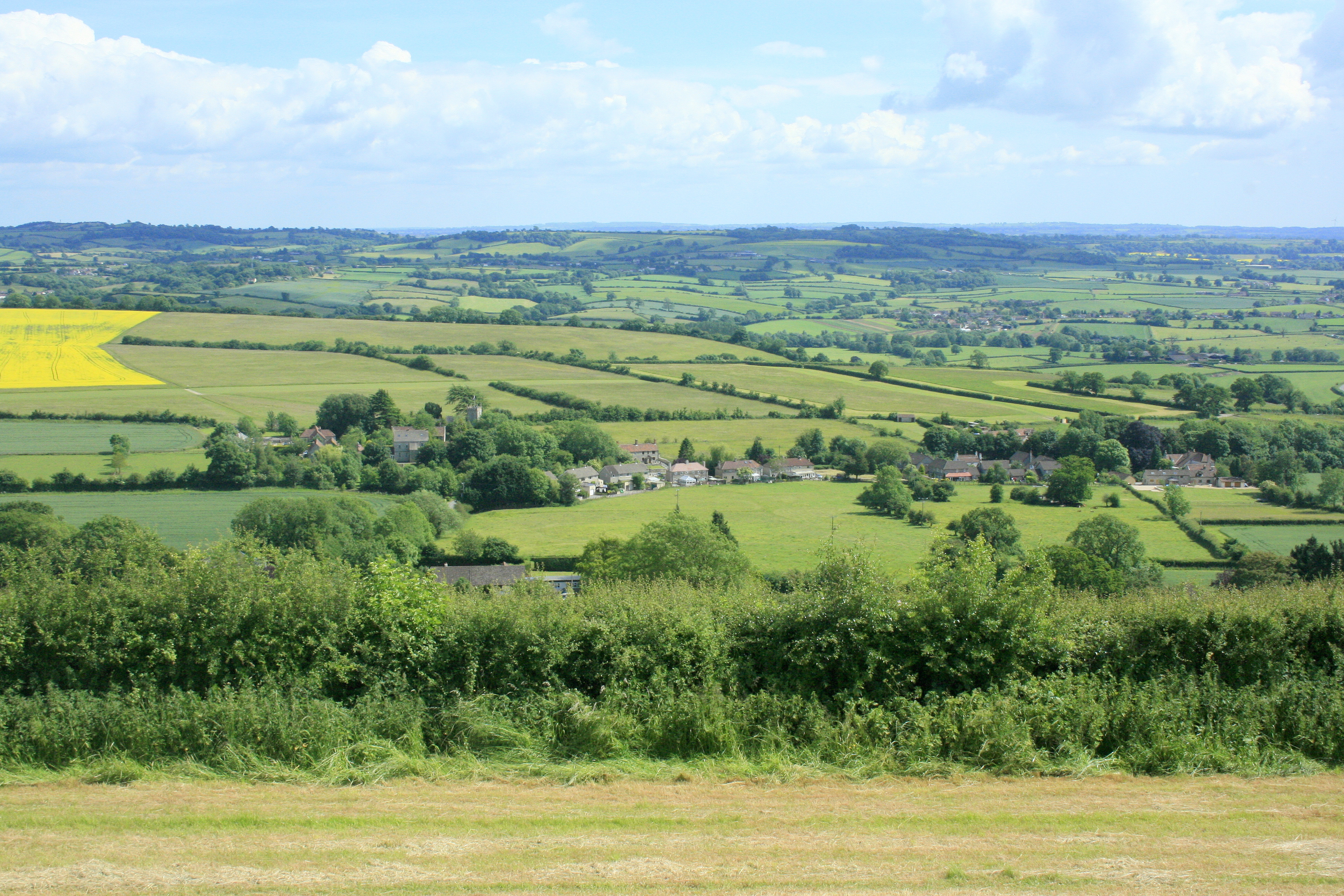
English: Norton Malreward from Maes Knoll. Turning right from 1383481 and facing almost due south, Norton Malreward appears, its parish church can be seen among the trees.
An interesting story is told in: http://www.themodernantiquarian.com/post/39162/maes_knoll.html "This [Maes Knoll] is where Hautville's Quoit was thrown from, by Sir John Haut(e)ville (you can read more about this on the Hautville's Quoit page). He was just rehearsing for a throwing match with the Devil, which he ended up winning by throwing a rock from Shute Shelve to Compton Bishop (about a mile and a half) - the Devil threw 3 furlongs shorter. (from Grinsell's folklore book I think). Sir John is apparently bured [sic] in Chew Magna church, where there's an oak effigy of him. This gentleman was remarkable for prodigious strength, as the Irish oak is probably intended to denote. Vulgar tradition informs us, that Edward the First having requested Sir John to shew him a specimen of his abilities, the knight undertook to convey three of the stoutest men in England to the top of Norton Tower [Norton Malreward is at the foot of Maes Knoll], situated in a neighbouring parish. Accordingly, taking one under each arm, and a third in his teeth, he proceeded on his task. The two in his arms, making some resistance, were squeezed to death, but the other was carried up without sustaining the smallest injury" |
| Ji̍t-kî | |
| Chhut-chhù | From geograph.org.uk |
| Chok-chiá | Maurice Pullin |
| 授權允准 (Bô siŏh-huòi sāi ciā ùng-giông) |
Creative Commons Attribution Share-alike license 2.0 |
| 拍攝地點 | | 位於此地的本圖片與其他圖片: OpenStreetMap |
|---|
Siū-khoân

|
此圖像來自Geograph工程圖集。攝影師的聯繫資訊請見Geograph網站上該照片的頁面。此圖像的著作權人為Maurice Pullin,採用創用CC 署名-相同方式共享 2.0許可協議授權二次使用。
|
- 你會使自由:
- 分享 – kho͘-pih, hoat-pò͘ kap thoân-pò͘ pún chok
- 重新修改 – kái-pian pún chok-phín
- Àn i-hā ê tiâu-kiāⁿ
- 標示名姓 – 您必須指名出正確的製作者,和提供授權條款的連結,以及表示是否有對內容上做出變更。您可以用任何合理的方式來行動,但不得以任何方式表明授權條款是對您許可或是由您所使用。
- 仝款方式方享 – Lí nā kái-tōng, piàn-khoán, he̍k-chiá kun-kù pún chok chhòng-chō, lí kaⁿ-taⁿ ē-tàng ēng kap pún chok kâng-khoán he̍k-chiá saⁿ-chhiūⁿ ê hí-khó lâi hoat-pò͘ chò--chhut-lâi ê chok-phín.
Tóng-àn le̍k-sú
Chhi̍h ji̍t-kî/sî-kan, khoàⁿ hit sî-chūn--ê tóng-àn.
| Ji̍t-kî/Sî-kan | 細張圖 | 寸尺 | Iōng-chiá | Chù-kái | |
|---|---|---|---|---|---|
| hiān-chāi | 2017-nî 9-goe̍h 8-ji̍t (pài-gō·) 23:11 | | 3,888 × 2,592(6.14 MB) | Geograph Update Bot | Higher-resolution version from Geograph. |
| 2009-nî 10-goe̍h 4-ji̍t (lé-pài) 09:42 |  | 640 × 427(150 KB) | Rodw | {{Information |Description=Norton Malreward from Maes Knoll |Source=From [http://www.geograph.org.uk/photo/1384392 geograph.org.uk] |Date=2009-06-16 |Author=[http://www.geograph.org.uk/profile/14368 Maurice Pullin] |Permission=Creative Commons Attribution |
Iáⁿ-siōng liân-kiat
Í-hā ê ia̍h liân kàu chit ê iáⁿ-siōng:
tóng-àn hō͘ lâng sái--ê chōng-hóng
Ē-kha--ê kî-thaⁿ wiki ēng tio̍h chit--ê tóng-àn:
- ceb.wikipedia.org hō͘ lâng ēng--ê chêng-hêng
- en.wikipedia.org hō͘ lâng ēng--ê chêng-hêng
- fr.wikipedia.org hō͘ lâng ēng--ê chêng-hêng
- lld.wikipedia.org hō͘ lâng ēng--ê chêng-hêng
- pl.wikipedia.org hō͘ lâng ēng--ê chêng-hêng
- www.wikidata.org hō͘ lâng ēng--ê chêng-hêng