
tóng-àn:West Midlands UK location map.svg

此 SVG 檔案的 PNG 預覽的大小:800 × 547 siōng-sò͘。 Kî-thaⁿ--ê kái-sek-tō͘: 320 × 219 siōng-sò͘ | 640 × 437 siōng-sò͘ | 1,024 × 700 siōng-sò͘ | 1,280 × 875 siōng-sò͘ | 2,560 × 1,750 siōng-sò͘ | 1,425 × 974 siōng-sò͘.
Choân kái-sek-tō͘ (SVG ùng-giông, chék-cháung: 1,425 × 974 chuông-só, ùng-giông duâi-nâung:1.35 MB)
|
|
Che sī tùi Wikimedia Commons ín--lâi ê chi̍t hūn tóng-àn. I tī hia ê kì-su̍t-ia̍h téng-bīn ê chu-sìn hián-sī ùi ē-té. |
| Soat-bêng |
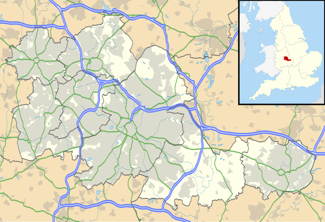
Map of the West Midlands, UK with the following information shown:
Equirectangular map projection on WGS 84 datum, with N/S stretched 160% Geographic limits:
|
| Ji̍t-kî | |
| Chhut-chhù |
|
| Chok-chiá | Nilfanion, created using Ordnance Survey data |
| 授權允准 (Bô siŏh-huòi sāi ciā ùng-giông) |
此檔案採用創用CC 姓名標示-相同方式分享 3.0 未在地化版本授權條款。 Biĕu-sê miàng-sáng: Contains Ordnance Survey data © Crown copyright and database right
|
| 其他版本 | File:West Midlands UK district map (blank).svg - Blank map |
.svg)
Tóng-àn le̍k-sú
Chhi̍h ji̍t-kî/sî-kan, khoàⁿ hit sî-chūn--ê tóng-àn.
| Ji̍t-kî/Sî-kan | 細張圖 | 寸尺 | Iōng-chiá | Chù-kái | |
|---|---|---|---|---|---|
| hiān-chāi | 2010-nî 9-goe̍h 26-ji̍t (lé-pài) 19:17 | | 1,425 × 974(1.35 MB) | Nilfanion | {{Information |Description=Map of the West Midlands, UK with the following information shown: *Administrative borders *Coastline, lakes and rivers *Roads and railways *Urban areas Equirectangular map projection on WGS 84 datu |
Iáⁿ-siōng liân-kiat
Í-hā ê ia̍h liân kàu chit ê iáⁿ-siōng:
tóng-àn hō͘ lâng sái--ê chōng-hóng
Ē-kha--ê kî-thaⁿ wiki ēng tio̍h chit--ê tóng-àn:
- ar.wikipedia.org hō͘ lâng ēng--ê chêng-hêng
- ast.wikipedia.org hō͘ lâng ēng--ê chêng-hêng
- bg.wikipedia.org hō͘ lâng ēng--ê chêng-hêng
- ceb.wikipedia.org hō͘ lâng ēng--ê chêng-hêng
- en.wikipedia.org hō͘ lâng ēng--ê chêng-hêng
- Moseley
- Moseley and Kings Heath (ward)
- Coventry Cathedral
- Coventry Transport Museum
- 2002–03 FA Premier League
- 2003–04 FA Premier League
- Walsall
- West Bromwich
- Dudley
- Tipton
- Birmingham Airport
- Soho House
- Aston
- Smethwick
- Oldbury, West Midlands
- Rowley Regis
- Birmingham Town Hall
- Birmingham Museum and Art Gallery
- Aldridge
- Sutton Coldfield
- Bilston
- Sutton Park, West Midlands
- Blackheath, West Midlands
- Black Country Living Museum
- Dudley Castle
- Willenhall
- Halesowen
- Knowle, West Midlands
- Stourbridge
- Brierley Hill
- Brownhills
- Hampton in Arden
- Spaghetti Junction, Birmingham
- Edgbaston
- Sedgley
- Harborne
- Soho, West Midlands
- Birmingham Botanical Gardens, England
- 2004–05 FA Premier League
- Thinktank, Birmingham Science Museum
- Bournville
- Hall Green
- Northfield, Birmingham
檢視此檔案的更多全域使用狀況。