
tóng-àn:Wothorpe Towers - geograph.org.uk - 1621167.jpg
Seng khoàⁿ chiàm-liōng: 800 × 600 siōng-sò͘. Kî-thaⁿ--ê kái-sek-tō͘: 320 × 240 siōng-sò͘ | 640 × 480 siōng-sò͘ | 1,024 × 768 siōng-sò͘ | 1,280 × 960 siōng-sò͘ | 2,560 × 1,920 siōng-sò͘ | 4,000 × 3,000 siōng-sò͘.
Choân kái-sek-tō͘ (4,000 × 3,000 siōng-sò͘ , tóng-àn chiàm-liōng: 4.47 MB, MIME luī-hêng: image/jpeg)
|
|
Che sī tùi Wikimedia Commons ín--lâi ê chi̍t hūn tóng-àn. I tī hia ê kì-su̍t-ia̍h téng-bīn ê chu-sìn hián-sī ùi ē-té. |
This is a photo of listed building number 1265972. |
Khài-iàu
| Soat-bêng |
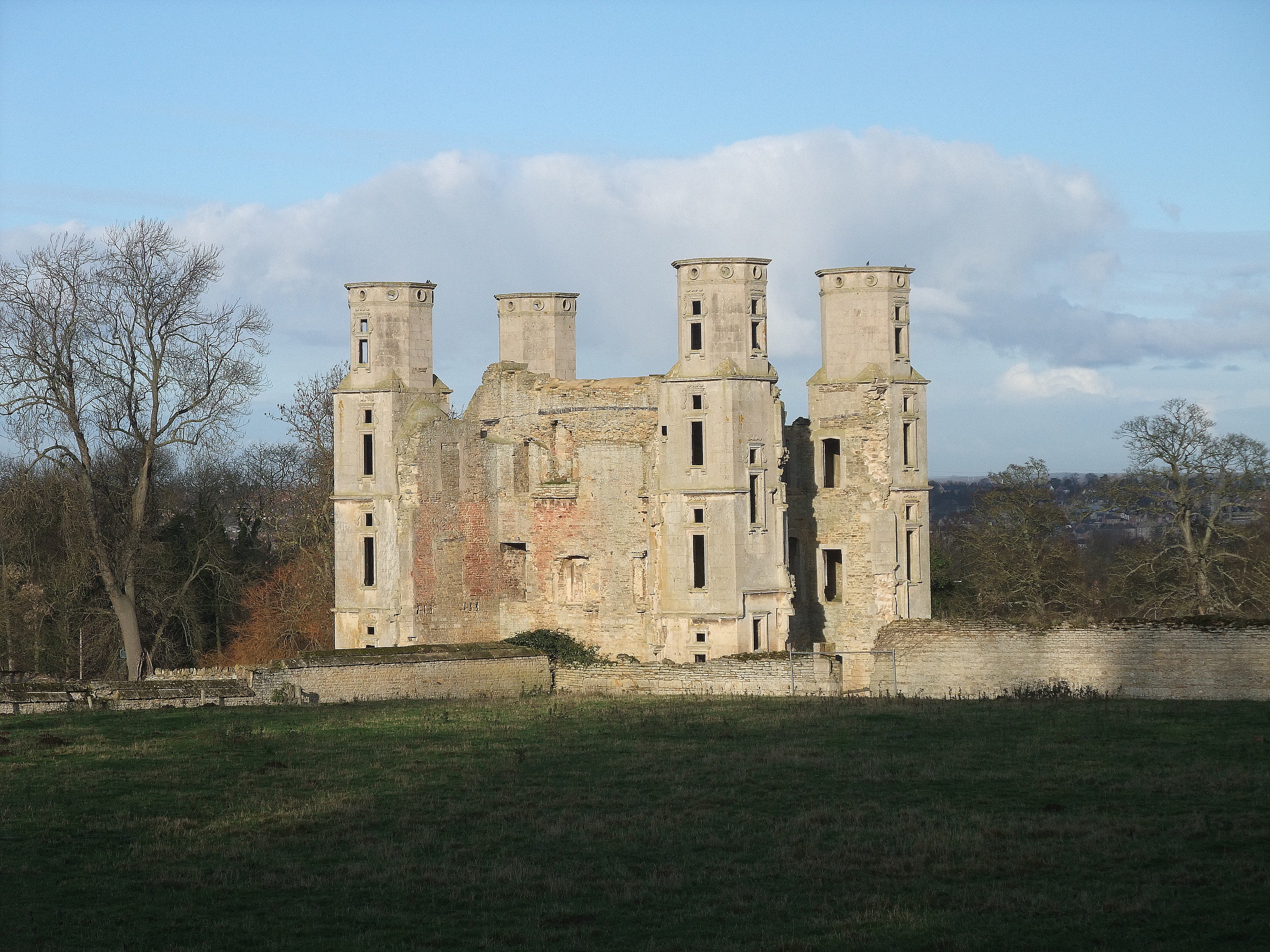
English: Wothorpe Towers, near to Easton on The Hill, Northamptonshire, Great Britain.
Grade I listed. Built by Thomas Cecil, eldest son of Lord Cecil of Burghley, in the early 17th century. Now undergoing extensive restoration <a title="http://www.wothorpe-towers.co.uk/" rel="nofollow" href="http://www.wothorpe-towers.co.uk/">Link</a><img style="padding-left:2px;" alt="External link" title="External link - shift click to open in new window" src="http://s0.geograph.org.uk/img/external.png" width="10" height="10"/> |
| Ji̍t-kî | |
| Chhut-chhù | From geograph.org.uk; transferred by User:Skinsmoke using geograph_org2commons. |
| Chok-chiá | Tim Heaton |
| 授權允准 (Bô siŏh-huòi sāi ciā ùng-giông) |
Creative Commons Attribution Share-alike license 2.0 |
| Biĕu-sê miàng-sáng (由许可协议要求) | Tim Heaton / Wothorpe Towers / |
| 拍攝地點 | | 位於此地的本圖片與其他圖片: OpenStreetMap |
|---|
| 目標地點 | | 位於此地的本圖片與其他圖片: OpenStreetMap |
|---|
_region:GB-GBN_heading:0.00&language=nan)
Siū-khoân

|
此檔案採用創用CC 姓名標示-相同方式分享 2.0 通用版授權條款。
Biĕu-sê miàng-sáng: Tim Heaton
- 你會使自由:
- 分享 – kho͘-pih, hoat-pò͘ kap thoân-pò͘ pún chok
- 重新修改 – kái-pian pún chok-phín
- Àn i-hā ê tiâu-kiāⁿ
- 標示名姓 – 您必須指名出正確的製作者,和提供授權條款的連結,以及表示是否有對內容上做出變更。您可以用任何合理的方式來行動,但不得以任何方式表明授權條款是對您許可或是由您所使用。
- 仝款方式方享 – Lí nā kái-tōng, piàn-khoán, he̍k-chiá kun-kù pún chok chhòng-chō, lí kaⁿ-taⁿ ē-tàng ēng kap pún chok kâng-khoán he̍k-chiá saⁿ-chhiūⁿ ê hí-khó lâi hoat-pò͘ chò--chhut-lâi ê chok-phín.
Tóng-àn le̍k-sú
Chhi̍h ji̍t-kî/sî-kan, khoàⁿ hit sî-chūn--ê tóng-àn.
| Ji̍t-kî/Sî-kan | 細張圖 | 寸尺 | Iōng-chiá | Chù-kái | |
|---|---|---|---|---|---|
| hiān-chāi | 2021-nî 7-goe̍h 23-ji̍t (pài-gō·) 02:42 | | 4,000 × 3,000(4.47 MB) | Geograph Update Bot | Higher-resolution version from Geograph |
| 2010-nî 9-goe̍h 30-ji̍t (pài-sì) 09:05 |  | 640 × 480(62 KB) | File Upload Bot (Magnus Manske) | == {{int:filedesc}} == {{Information |Description={{en|1=Wothorpe Towers, near to Easton on The Hill, Northamptonshire, Great Britain. Grade I listed. Built by Thomas Cecil, eldest son of Lord Cecil of Burghley, in the early 17th century. Now undergoing e |
Iáⁿ-siōng liân-kiat
Í-hā ê ia̍h liân kàu chit ê iáⁿ-siōng:
tóng-àn hō͘ lâng sái--ê chōng-hóng
Ē-kha--ê kî-thaⁿ wiki ēng tio̍h chit--ê tóng-àn:
- ceb.wikipedia.org hō͘ lâng ēng--ê chêng-hêng
- dag.wikipedia.org hō͘ lâng ēng--ê chêng-hêng
- en.wikipedia.org hō͘ lâng ēng--ê chêng-hêng
- fr.wikipedia.org hō͘ lâng ēng--ê chêng-hêng
- sv.wikipedia.org hō͘ lâng ēng--ê chêng-hêng
- www.wikidata.org hō͘ lâng ēng--ê chêng-hêng